
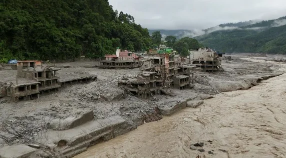
WASHINGTON, Aug 27: The devastating flash floods in Nepal were triggered by a glacial collapse and debris flow rather than an earthquake, the US Geological Survey (USGS) said, revising its earlier assessment of the event.
The USGS initially reported the seismic activity as a magnitude 4.4 earthquake. However, further analysis of seismic data, long-period waves from nearby stations and satellite imagery established that no earthquake had occurred.
The agency subsequently revised the magnitude of the seismic event to 5.2, clarifying that it was associated with a glacial collapse and debris flow that caused catastrophic flooding downstream.
The disaster, which originated in Tibet on Wednesday, caused widespread destruction in Nepal's Rasuwa and Dhading districts. At least 162 people were killed and around 750 remain missing, including 133 Indian nationals.
The USGS said the glacial collapse generated a massive debris flow, which subsequently triggered the devastating flooding downstream.
Daniel Shugar, an associate professor of geomorphology at the University of Calgary in Canada, said the floods may have been triggered when a glacier rolled off a cliff at an altitude of around 5,200 metres.
Comparing satellite imagery captured before and after the disaster, Shugar observed that glaciers in the area appeared to have lost a significant amount of snow within 24 hours.
He suggested that snow and glacier-ice melt may have introduced substantial quantities of water into the glacier, lubricating its base and contributing to the collapse.